Sendero Las Breñas: Hiking to the Costa de Acentejo in El Sauzal
Sendero Las Breñas connects a clifftop viewpoint in El Sauzal with the volcanic shoreline below. Combine the descent with the Paseo Litoral Costa Acentejo for a walk through coastal scrub, dark lava formations and small bays, with a very different perspective on Tenerife’s northern cliffs.
In this guide
Where is Sendero Las Breñas?
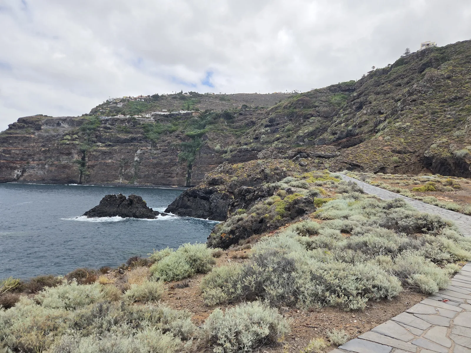
The trail begins at Mirador de Las Breñas, on Calle Castaño in the La Primavera residential area of El Sauzal, northern Tenerife. It descends towards El Puertito and joins the coastal walking area within the Paisaje Protegido Costa de Acentejo. Here, houses above the escarpment give way to open slopes and a shoreline shaped by lava and Atlantic waves.
Two different outings are often described under the same name: the hillside hike from the viewpoint and a gentler walk along the coast reached by road. Decide which you want before setting your navigation. Driving to the lower parking area removes the main descent and return climb, but also misses the changing views along Las Breñas.
The council’s combined trail description gives 6 kilometres, two hours and low difficulty, returning to the starting point. Treat that as a route reference: the distance you actually walk depends on how far you explore the coastal branches. Allow around three hours if you prefer an unhurried pace with photographs and rests.
Start at Mirador de Las Breñas
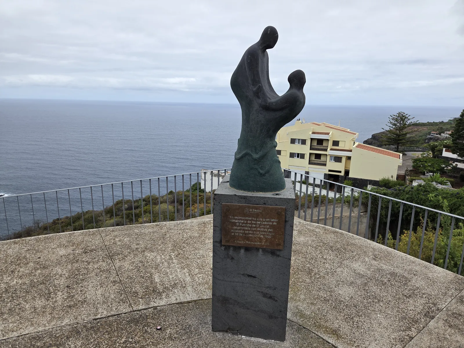
Before descending, spend a few minutes at the viewpoint. Its position above the slope helps explain the route: the sea looks close, but reaching it involves a proper hillside walk. The panorama also makes this a worthwhile stop for companions who prefer to remain above the coast.
The sculpture here commemorates the fishermen who helped rescue survivors of the 1966 aircraft accident off El Sauzal. Installed in 2014, it gives the viewpoint a connection with the community’s maritime history, beyond the scenery.
Descending Sendero Las Breñas
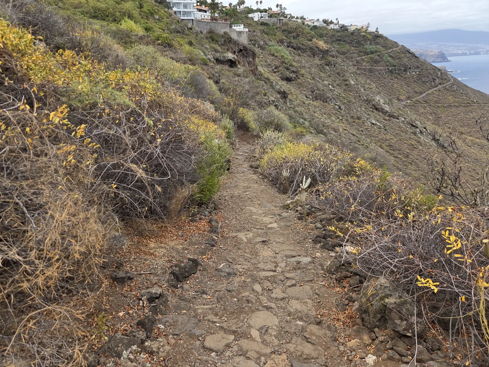
From the viewpoint, follow the established footpath downhill towards the coast. This is the hiking portion of the outing: an uneven path across a scrub-covered slope, with embedded stones and stretches where watching your footing matters more than maintaining speed. The vegetation leaves much of the hillside exposed to sun.
The descent provides the strongest sense of the landscape’s scale. Looking across the slope, you can trace the separation between the residential streets above and the lava shoreline below. Pause in wider places to enjoy the view rather than walking while looking out to sea.
Keep the return in mind from the beginning. A comfortable downhill pace can disguise the effort required to climb back, particularly on a warm afternoon. Unless you have arranged transport elsewhere, retracing Las Breñas provides a straightforward finish without adding unfamiliar road walking.
Exploring the Paseo Litoral Costa Acentejo
On reaching the coastal walking area, the outing changes character. Follow the prepared paths around the shoreline, choosing your turnaround according to time and energy. El Puertito and the Rojas sector are the main names to recognise; the pleasure lies in exploring their succession of bays, rocky projections and contrasting views back towards the cliffs.
Punta de El Puertito forms a peninsula beside Callao de Los Parrales. The latter is a stony beach with difficult access, rather than an easy sandy extension of the promenade. El Cangrejillo and Rojas are other named coastal places identified by the council. You do not need to reach every inlet to enjoy a complete walk.
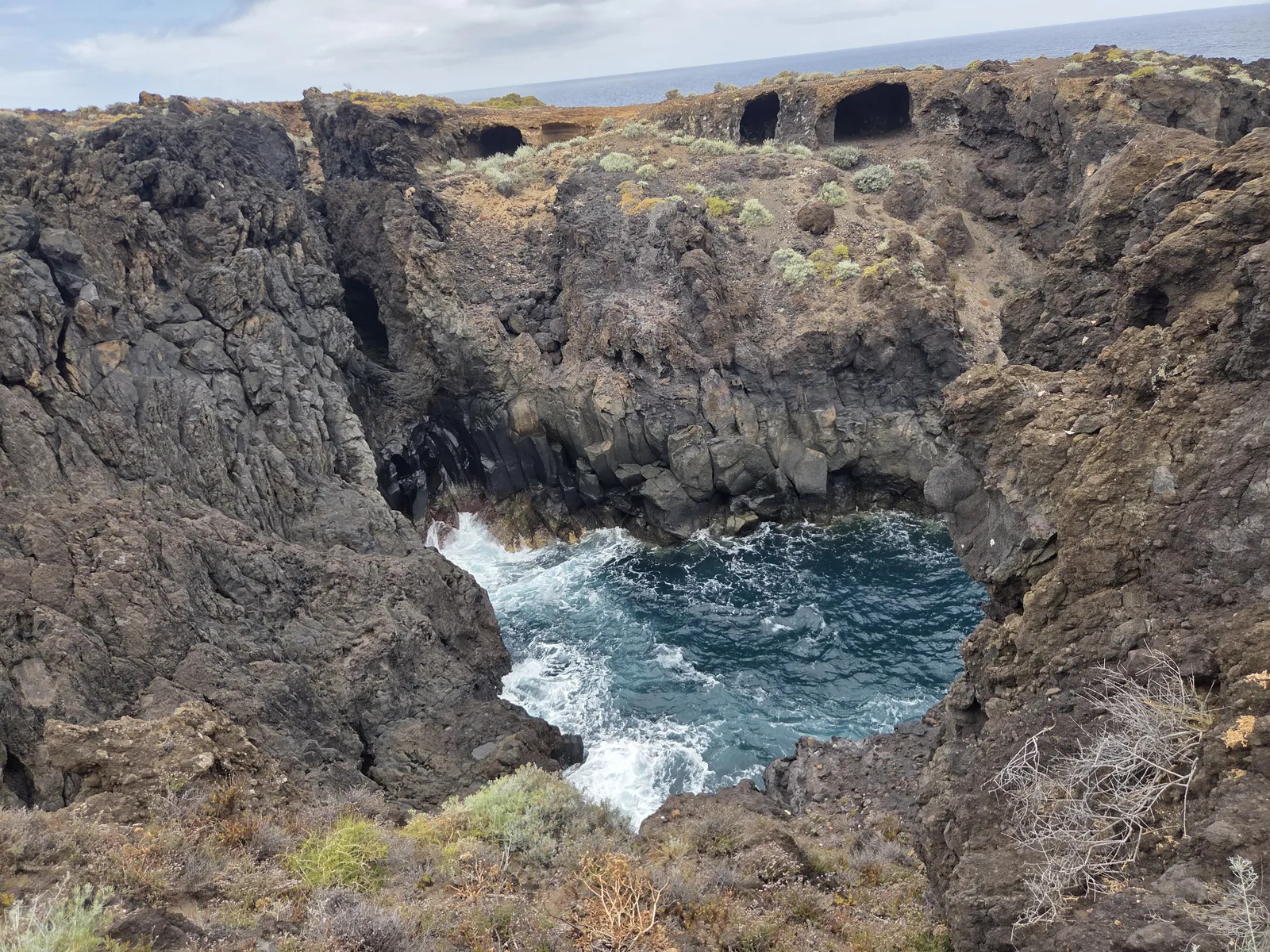
Look closely at the lava formations: narrow channels, fractured rock and cavities make the shoreline more varied than it appears from above. Stay on established paths when examining them. A sheltered-looking inlet can still receive powerful surges, and an attractive rock basin should not automatically be treated as a swimming pool.
Difficulty, footwear and what to bring
Although the municipal route is classified as easy, the full walk requires confidence on uneven ground and enough stamina for the uphill return. The lower promenade and the hillside trail should not be judged as equivalent terrain. The complete descent is unsuitable for a pushchair or wheelchair.
Wear walking shoes with a dependable grip, and bring water, sun protection and a light windproof layer. Carry your water from the outset rather than relying on a refill. A small snack is useful if you extend the coastal portion, and walking poles may help anyone who finds stony descents uncomfortable.
Choose a day without severe coastal or weather warnings. Wet stones can be slippery, while heat makes the exposed climb harder. Respect any barriers or instructions encountered locally, and keep children close beside drops and rough shoreline edges.
Getting there and parking
For the full hike, navigate to Mirador de Las Breñas on Calle Castaño, La Primavera. Park legally in the surrounding residential streets without blocking entrances. For the lower coastal walk, the council identifies the vehicle access at Carretera de Las Breñas, number 76. The descending road is narrow and carries traffic in both directions, so drive slowly.
The council publishes coastal access hours of 08:00–22:00 in summer and 08:00–19:00 during the rest of the year. Check its coastal access information before travelling and follow the signs at the entrance. Some lower parking spaces have a two-hour limit; read the restrictions for your particular bay.
If travelling by bus, check the current journey to El Sauzal with TITSA and examine the remaining distance to Calle Castaño. Do not assume a service to the town centre delivers you to the trailhead or shoreline.
How to fit the walk into your day
For a satisfying half-day outing, start at the viewpoint, descend Las Breñas, explore part of the coastal promenade and return before the climb becomes a race against daylight. Morning is a practical choice on warm days. Carry enough food if you want to linger, then leave a meal in El Sauzal for after the hike.
If your priority is a short coastal stroll, use the lower access and choose a modest out-and-back walk. Sunset can be atmospheric, but anyone returning uphill should allow ample daylight. The best version of Las Breñas combines time beside the sea with enough energy to enjoy the climb back.