El Draguillo to Chamorga: Hiking over Cruz del Draguillo in Anaga
The walk from El Draguillo to Chamorga crosses one of northeastern Tenerife’s steep divides, linking a small hamlet above the Atlantic with a village tucked into Anaga’s mountain interior. Following the direct PR-TF 6 connection over Cruz del Draguillo, it combines a demanding uphill stretch, greener upper slopes and a descent into Chamorga.
In this guide
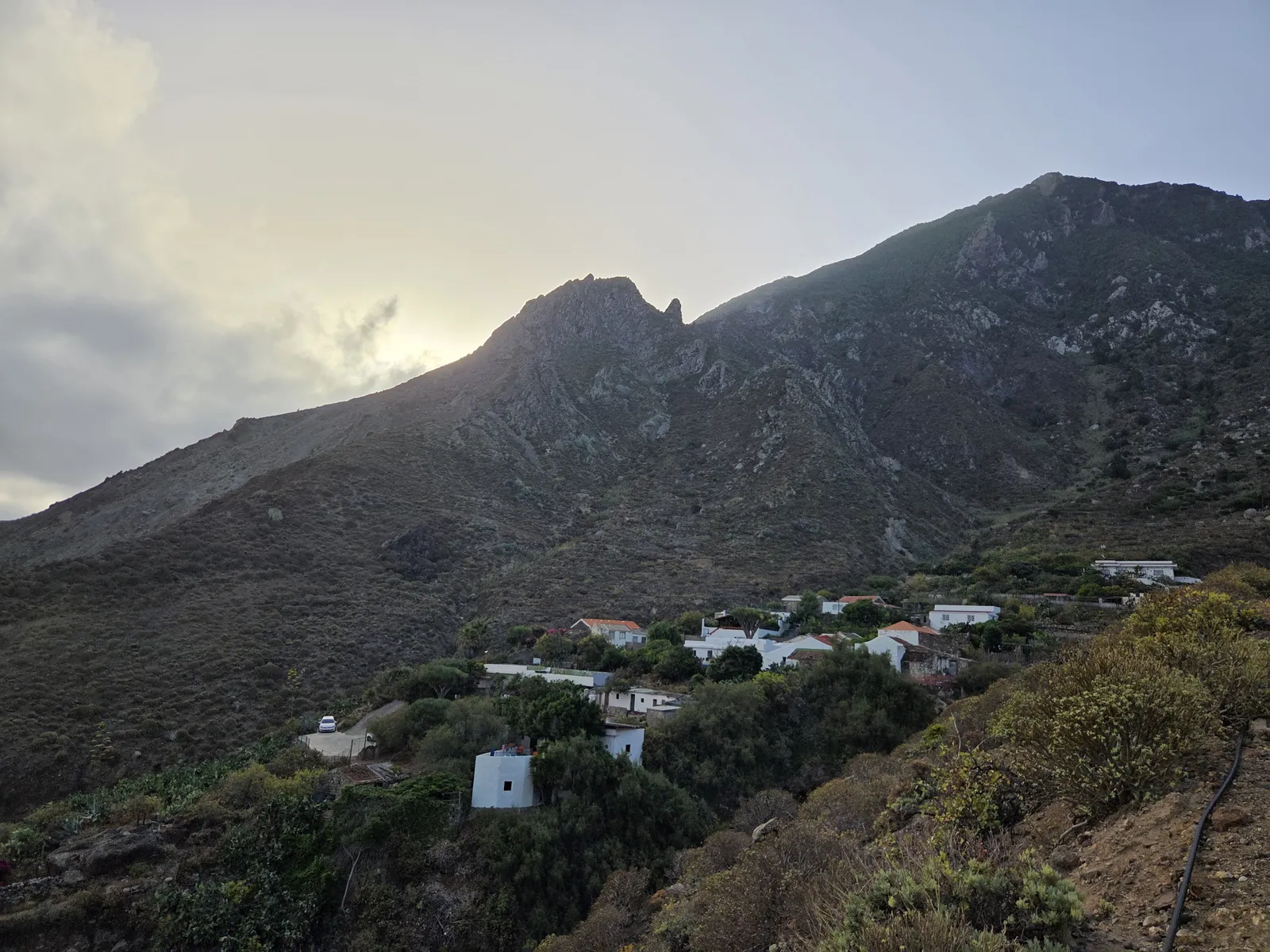
Route overview: a short distance with a substantial climb
El Draguillo and Chamorga belong to the municipality of Santa Cruz de Tenerife, within Anaga Rural Park. Although close on the map, the two settlements occupy different sides of mountainous terrain. The direct walking connection climbs inland from El Draguillo to Cruz del Draguillo before dropping towards Chamorga.
The photographed PR-TF 6 sign at El Draguillo indicates 2.7 km to Chamorga. Treat that as the distance from the sign, rather than from a parking space in Benijo or a bus stop farther along the coast. For planning, allow approximately 1½–2½ hours one way, including short rests; this is a practical allowance rather than an official trail time.
The essential distinction is between this direct crossing and the much longer itineraries involving Las Palmas de Anaga, Faro de Anaga and Roque Bermejo. They belong to the same wider walking network, but their distances, terrain and transport implications are very different.
Walking from El Draguillo to Chamorga
Leave El Draguillo on the inland trail
At El Draguillo, identify the PR-TF 6 direction for Chamorga. The separate PR-TF 6.2 signs point towards Benijo and Almáciga. Taking a moment to confirm the junction prevents an easy mistake: continuing along the coastal approach when your destination is across the ridge.
The hamlet’s houses, terraces and retaining walls give the opening stretch a distinctly rural character. These paths connect places where people live and work, so keep to the public route, leave entrances clear and avoid stepping onto cultivated plots for photographs.
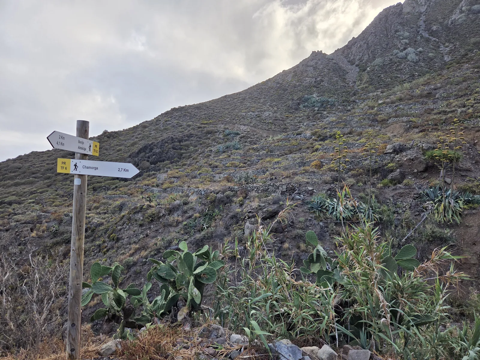
Climb towards Cruz del Draguillo
The main effort comes on the ascent from El Draguillo. The trail gains height through the steep hillside, leaving the settlement below. Rocky ground, bends and changes in gradient make a measured pace more useful than trying to maintain your usual speed on level ground.
As you climb, the landscape changes from relatively open lower slopes towards the greener vegetation of the upper mountain. Conditions can change just as noticeably: a warm start near the coast may lead into cool cloud higher up. Look back from secure stopping places to appreciate the hamlet’s position beneath the surrounding ridges.
Cross the divide and descend into Chamorga
At Cruz del Draguillo, check the signposted continuation towards Chamorga against your downloaded map. Other paths serve the surrounding ridges, including the connection towards Benijo; following whichever branch appears most obvious is an unreliable way to navigate.
The route then descends into the valley towards Chamorga. Reaching the divide does not mean the walking is finished: allow time for the downhill section, particularly when the surface is damp. The village provides a natural endpoint, with houses gathered beneath steep, green slopes and the TF-123 road giving access from the rest of the island.

How difficult is the walk?
This is a mountain walk requiring reasonable fitness and confident footing. Its modest distance can be misleading: the sustained ascent is the principal physical challenge, while uneven stones, loose material and narrow hillside sections demand attention. It is unsuitable for wheelchairs or pushchairs.
Regular hikers will generally find the climb more significant than any technical obstacle in normal conditions. Beginners should allow generous time and avoid combining it with an ambitious coastal circuit. Anyone uncomfortable on steep, unprotected paths should assess the terrain carefully rather than relying on the route’s short length.
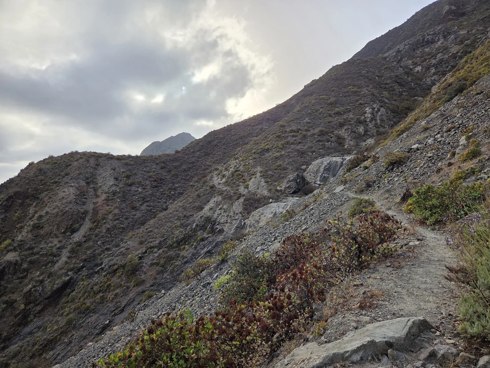
Rain increases the difficulty considerably. Wet rock and muddy sections can slow progress, especially downhill. Walking poles may help with balance, but they do not replace suitable shoes or the decision to turn back when conditions deteriorate.
Choose your return route before setting off
Returning the same way is the simplest arrangement when your vehicle remains on the El Draguillo side. It also means climbing back out of Chamorga and descending again to El Draguillo. Allow roughly 4–5 hours for a relaxed return outing between the hamlets, with additional time for any approach from Benijo.
Finishing in Chamorga avoids retracing the crossing, but requires a workable bus departure or a prearranged collection. The settlements are separated by a much longer road journey than their walking distance suggests, so do not assume retrieving a car will be quick.
Extending towards Tafada, the lighthouse or Roque Bermejo creates a different undertaking. PR-TF 6.1 serves the Chamorga–Casas de Tafada–Faro de Anaga connection, while other sections link the coastal settlements. Check every intended section independently; the condition of the direct crossing does not establish the condition of the longer circuit.
Access, parking and public transport
For the coastal approach, plan around Benijo and the onward walking connection to El Draguillo. Do not assume the narrow access beyond Benijo provides unrestricted visitor driving or convenient parking. Use permitted spaces, respect local signs and include the approach distance in your itinerary.
Chamorga is reached by the winding TF-123. Parking space in the village is limited, and turning areas, residential entrances and bus access must remain clear.
TITSA route 947 connects Santa Cruz with Chamorga via San Andrés and El Bailadero. For the coastal side, route 946 serves the Almáciga corridor, requiring an additional walking approach. Check actual stops, weekday or weekend departures and service notices before committing to a linear walk.
Weather, trail checks and what to bring
Choose a day with stable weather and enough daylight for your complete itinerary. Check the forecast for Anaga’s mountains as well as the coast: low cloud can obscure junctions, and strong wind can make exposed sections uncomfortable.
Before departure, consult Tenerife ON for current trail information, alerts and restrictions affecting your intended sections. Follow any barriers or instructions encountered on the ground.
Carry water for the whole walk, food, sun protection, a light waterproof layer and an offline map. Do not depend on village refreshments being available when you arrive. For a first visit, the direct crossing with a clearly arranged return offers a rewarding introduction to this corner of Anaga without turning the day into an unnecessarily complicated expedition.