Guama Mountain: Hiking from Tamaimo and Views of Tenerife’s Teno Massif
Guama Mountain rises above Tamaimo in western Tenerife, combining a rewarding climb with views of rugged ravines, the surrounding villages and Teide. The traditional route through Cruz de los Misioneros reveals a landscape shaped by farming, old footpaths and the steep terrain of the Teno massif.
In this guide
- Starting point
- Tamaimo, Santiago del Teide
- Reference circuit
- 4.4 km · approximately 2 h 40 min
- Terrain
- Rocky paths and sustained climbs
- Bring
- Hiking shoes, water and sun protection
Where is Guama Mountain?
Montaña de Guama stands beside Tamaimo, in the municipality of Santiago del Teide, inland from Puerto de Santiago and Los Gigantes. It forms part of the mountainous scenery around the Teno massif, where villages occupy the gentler ground between steep slopes and deeply cut ravines.
Its attraction is the change of perspective. From the coast, the mountains form a distant backdrop; from Guama, you can appreciate the shape of the valley, the position of Tamaimo and the contrast between inhabited slopes and rugged ridgelines. In clear weather, the inland panorama extends towards Teide and Tenerife’s higher volcanic landscape.
This is a walking destination rather than a roadside viewpoint. Reaching the higher ground involves climbing on uneven paths, so plan it as a mountain outing even if you are staying nearby. The short distance from the coastal resorts does not make the terrain less demanding.
The Guama hiking route from Tamaimo
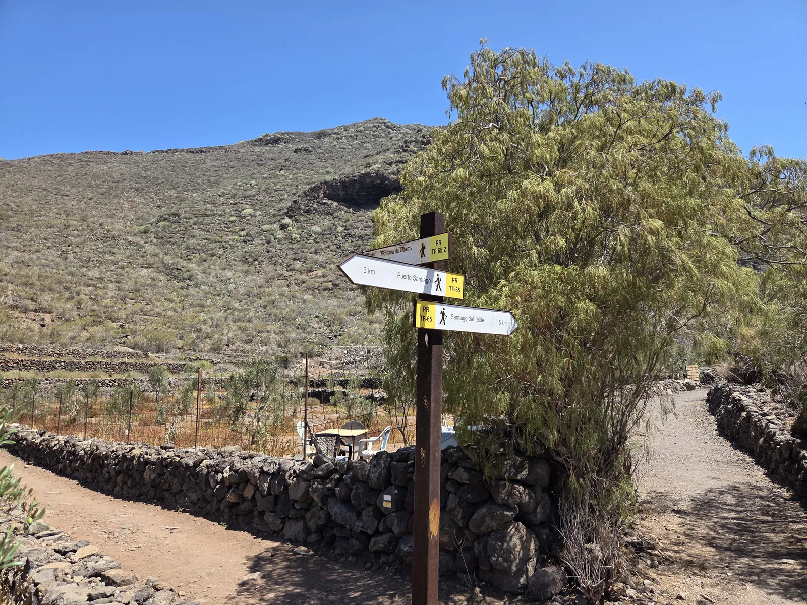
The municipal hiking guide describes PR-TF 65.2 as a circular route linking Tamaimo, Cruz de los Misioneros and Guama before returning to the village. Its reference figures are 4.4 kilometres and approximately 2 hours 40 minutes. Allow additional time for breaks, photographs and a slower descent.
These figures apply to the described circuit, not every walk published under the name “Guama Mountain”. Some recorded itineraries use different approaches or include extra destinations. Before downloading a track, compare its starting point, total ascent and return route with the outing you actually want to undertake.
Tamaimo’s Santa Ana church area is a useful landmark for orienting yourself in the village. Identify the correct trail access before starting, and carry an offline map rather than relying on a sequence of remembered junctions. Check the latest access information in the official municipal hiking guide, and follow any notices on the ground.
Cruz de los Misioneros and choosing your itinerary
Cruz de los Misioneros is a landmark associated with the Guama walk, but visiting the cross and completing the mountain circuit are different objectives. Decide beforehand whether you want a shorter return walk or the complete circuit, and assess the terrain of that specific itinerary.
For a first visit, keep the plan focused on Guama rather than adding every nearby attraction. El Bujero, the natural rock opening included in some longer routes, changes the character of the outing and needs separate consideration of navigation and exposure. A familiar name in a track description is not enough reason to extend your walk.
Views over Tamaimo, Teide and the surrounding mountains
The views develop as you gain height. Tamaimo’s houses spread across the valley below, while winding roads and terraces show how the settlements fit into the landscape. Looking inland, Teide can stand clearly above the intermediate ridges when visibility is good.
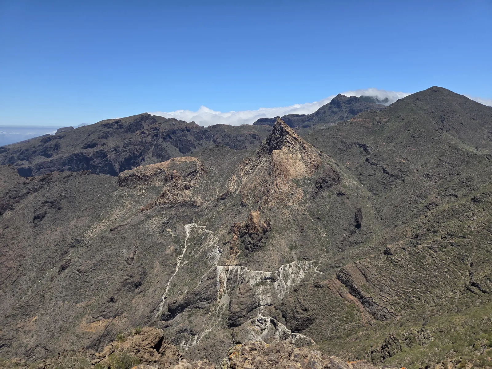
Across the neighbouring mountains, the scenery becomes more abrupt. Rocky crests, steep gullies and contrasting bands of exposed stone give the panorama depth. Guama is particularly rewarding for visitors interested in the relationship between the village landscape and the older mountain terrain surrounding it.
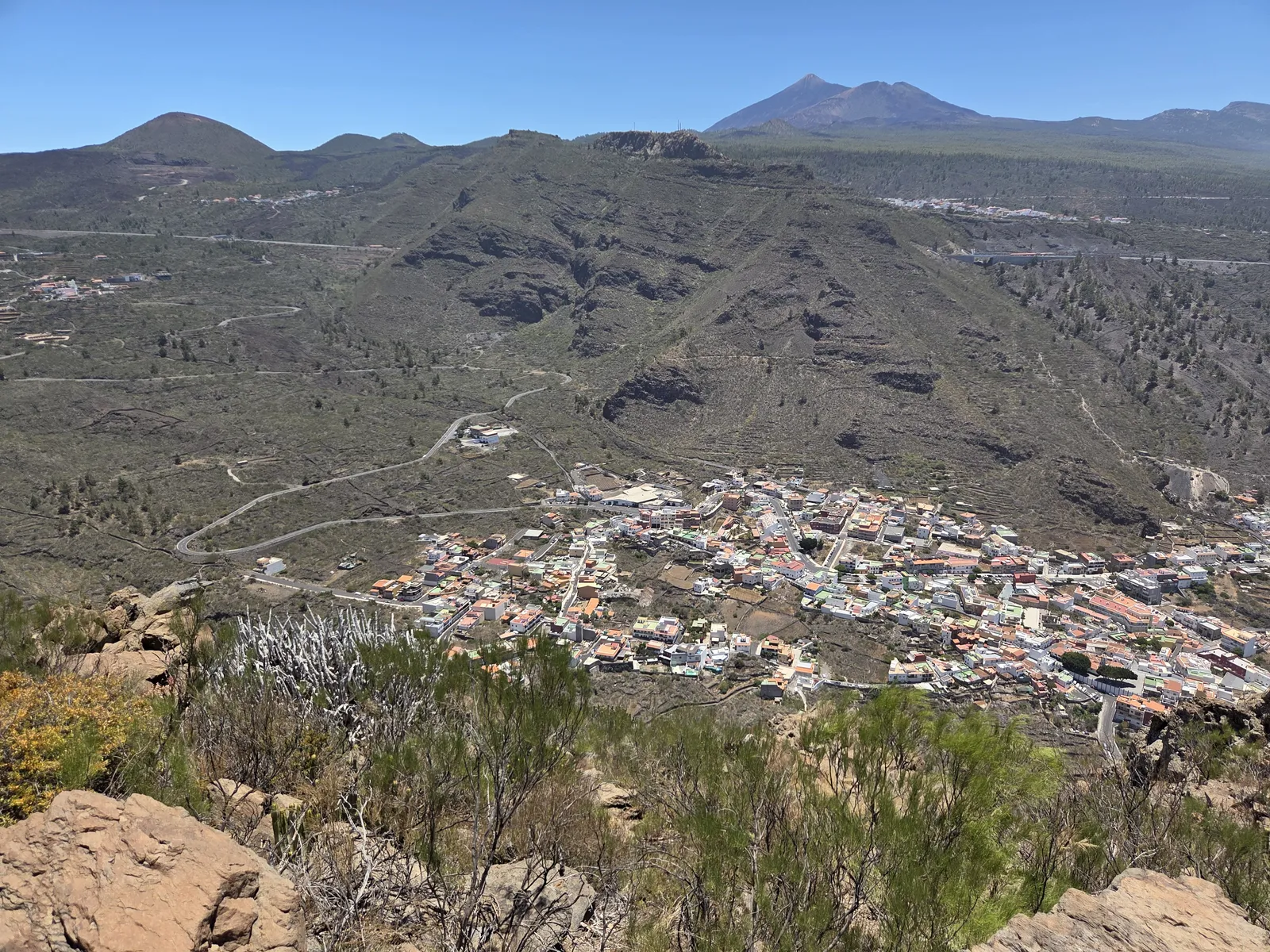
Visibility matters more than simply having sunshine. Haze or cloud can conceal the distant mountains even when the path itself is bright. For photographs, stop on stable ground and look for a composition that includes the valley or successive ridges without moving towards an exposed edge.
Make more of your Tenerife trip.
Compare excursions and activities to complement your time in the mountains.
How difficult is the Guama hike?
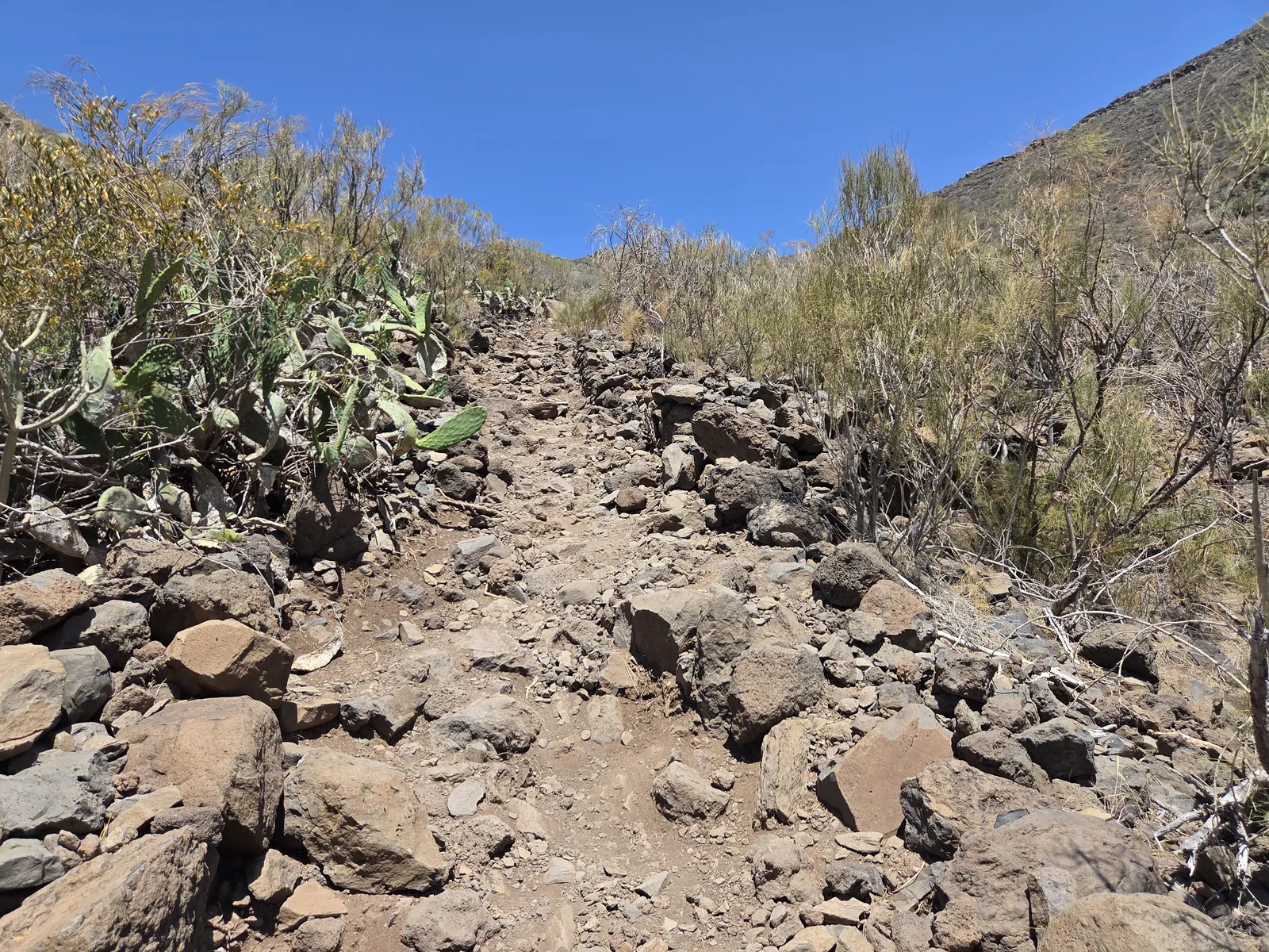
The main challenges are the climb and the footing. Expect uneven stone, loose material and stretches where the most comfortable pace is a steady, deliberate one. A relatively short route can still feel demanding when much of the effort is concentrated into an uphill section.
The descent deserves just as much attention. Tired legs and loose stones can make returning harder than expected, so avoid using all your energy on the ascent. Hiking shoes with reliable grip are a better choice than smooth-soled trainers, and walking poles may help if you are accustomed to using them.
Guama suits walkers comfortable with uphill effort and rough mountain paths. It is unsuitable for wheelchairs or pushchairs. If anyone in your group dislikes steep slopes or struggles with balance, assess the exact route rather than relying solely on a general difficulty label.
When to walk and what to bring
Choose a day with comfortable temperatures, good visibility and manageable wind. An early start gives you more flexibility for breaks and the return journey. During warmer periods, avoid committing to an exposed climb around the hottest part of the day.
Carry enough drinking water for the entire outing, a snack, sun protection and a light layer. Do not count on finding drinking water along the trail. Charge your phone, save the route offline and tell someone where you intend to walk.
Check weather warnings and access alerts through Tenerife ON before leaving. Stay on established paths, avoid shortcuts through terraces and leave stone walls and vegetation undisturbed. In an emergency, call 112.
Getting to Tamaimo and planning your day
Tamaimo is accessible by road from Santiago del Teide and the Los Gigantes area. Park in permitted village spaces without blocking entrances or narrow streets, then walk to the appropriate trail access. Leave time to find parking rather than assuming you can stop directly beside the start.
For public transport, TITSA route 462 serves Tamaimo and connects it with Los Gigantes and other settlements. Check the current direction, timetable and return departure before travelling; use the TITSA website to compare connections from your accommodation.
Allow a half-day for the walk and a relaxed stop in Tamaimo afterwards. A meal or a look around the Santa Ana church area makes a natural finish. Guama is most enjoyable when you leave enough time for the landscape, keep the itinerary realistic and return without rushing.